
Introduction
In Kannada, Kudremukh literally translates as “horse’s face.” The peak’s unusual form is what gave it this name. Historically, the place was also called Samseparvath as Samse village used to be the entry place.
Chikkamagaluru district’s Kudremukh lies tucked away in the middle of the western ghats. It is a section of the second-largest wildlife sanctuary area within the western ghats, Kudremukh National Park.
It is the third tallest mountain in Karnataka after Mullayyangiri and Baba Budangiri and is located at an elevation of 6,207 feet.
Location
Kudremukh trek is situated in the Chikmagaluru part of Karnataka state. The closest town to Kudremukh is called Kalasa which is approximately 20 km far.
Places to visit
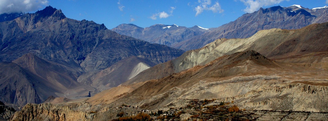
The peak’s 1. Horse’s Facial morphology
When viewed from the side, a characteristic feature on the Kudremukh peak resembles a horse’s face. This place can be seen after 1 hour of hiking from the office of the forest dept. There are still three hours of walking left, despite the fact that it seems to be coming closer.
Hiking in the Shola forest.
Locally, “shola” refers to the grasses and bushes that may be found in the western ghats. You must pass through shola forest in order to reach Kudremukh mountain.
Many animals, including deer, lion-tailed macaques, Malabar giant squirrels, leopards, common langurs, and many others, call this forest home. If you’re good lucked, you might witness them on hiking. Every step in this segment can be found with leeches during the monsoon season.
The small streams and falls in this area are one of its most mesmerizing features. On the route to the summit, you have to cross a lot of streams. When crossing, you might occasionally have to wet your shoes.
Magnificent Sight of the Rolling Hills
When you emerge from the shola forest, you are greeted with a breathtaking panorama of the surrounding hills. The lush, foggy valleys and hills are magnificent. This region may be entirely enveloped in mist during the monsoon. You shouldn’t pass up the opportunity to play hide and seek in the valley when it is shrouded in clouds and fog.
Itinerary
This Trek can be classified into 3 parts.
As follows:
From Ontimara 2, which bears a steep slope, to ultimate Stretch.
From the last portion to the summit, take the Ridge Walk
Part I: Ontimara 2 to Forest Office (Lone tree)
five kilometres to hike
Trek time: two hours
The forest office’s GPS coordinates are: 13° 9’6.61″n, 75°18’16.49″e The Ontimara 2’s GPS coordinates are: 13° 8’5.27″n, 75°17’3.87″e
To obtain the authorization, come to the forest office as soon as possible. The forest office is where the hike begins. Before you enter the woodland route, you can hear the sound of the water flowing at the Somawathi falls, and it follows you for a while.
See how the flora becomes more dense as you reach the Shola forest. If you’re fortunate, you may see some rare animals here. Earthworms and leeches abound in this woodland.
As you reach the final portion of your walk, the trek from the second Ontimara alternates between trekking across a gradual incline and a difficult rise. You can see the lovely, gently sloping green hills in this part, which is really attractive.
If you start your trip at 8 am, you should arrive at this location about 12 pm. Drink some water and then take a rest. Take in the vista.
From here, you may see the Kudremukh view’s back. Now, you are walking in the Kudremukh valley’s interior.
What time of year is ideal for beginning the Kudremukh trek
The Kudremukh should be performed as early in the day as feasible. To get to the top, it takes 4-5 hours, and it takes another 2.5 hours to go back.
The forest administration has made it illegal to go on a trip after 6 PM. By then, you must return to the homestay.
So what are you waiting for enjoy this one of a kind experience in the southern state of Karnataka. The southern part of India for many reason is under represented as a spot of exploration and travel as well. The whole of Shayadri and Malayadri the full of such hill stations and you just need search a bit and explore the parts. The hills in this part are quite different from north India with lush green vegetation and diverse fauna and flora all around. The weather remains quite pleasant for most part of the year too.
So, happy travels.
Checkout: more awesome content
Comments are closed.